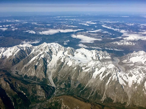
Andringitra Massif
Granite massif in Madagascar with varied slopes and ancient Precambrian origins.

The Andringitra Massif, meaning 'desert of rocks,' is a granite massif located within Andringitra National Park in Madagascar. The range is approximately 64 kilometres (40 mi) long. In its central area, the range is almost 10 kilometres (6.2 mi) wide, though it is much narrower on either end. Pic Boby, the highest peak, stands at 2658 meters (8,720 ft) high. The massif varies dramatically based on slope and altitude. The eastern slopes tend to be barren, with abrupt cliffs and channels scoured into the rock by erosion from tropical storms. The western slopes tend to slope more gradually, and are partly forested.
- geology
- Granite massif located on solid Precambrian ground, formed by a relatively sudde
Lore & Background
The Andringitra Massif is located in a relatively geologically-stable area, on solid Precambrian ground, which is evidence of the fact that these mountains were formed by a relatively sudden volcanic event. The mountains have many sharp cliffs and rises, as well as several volcanic formations. The Andringitra Massif contains many notable granite erosion sites, which have been formed over millions of years. The massif's base is tropical, but the forest gives way to thick carpets of lichen. At approximately 2,000 metres (6,600 ft), there is a belt of hardy shrubs. Above this belt the mountains are a grassland. Today, it is mainly occupied by herders and shepherds who move in a bid to find the freshest grazing grounds for their livestock. Tourists and adventurers have also visited the area as it provides both hiking and backpacking opportunities, as well as views of its geological formations.
Reader's Guide
The Andringitra Massif holds significance as a distinct geological feature within Madagascar, showcasing a range of ecosystems from tropical base to grassland above 2,000 metres. Its formation by a sudden volcanic event on ancient Precambrian ground makes it a subject of geological interest. The massif's varied terrain, including sharp cliffs and granite erosion sites, provides opportunities for hiking, backpacking, and viewing geological formations. Today, it is primarily occupied by herders and shepherds seeking fresh grazing grounds, as well as tourists and adventurers. The massif's dramatic altitudinal zones—from tropical forest to lichen carpets, hardy shrubs, and finally grassland—illustrate ecological transitions. Its legacy lies in its role as both a natural resource for local pastoralists and a destination for outdoor recreation, preserved within Andringitra National Park.
Did You Know?
- The name 'Andringitra Massif' means 'desert of rocks'.
- Pic Boby, the highest peak, stands at exactly 2,658 meters (8,720 ft).
- The massif is approximately 64 kilometres (40 mi) long and up to 10 kilometres (6.2 mi) wide in its central area.
- The eastern slopes are barren with abrupt cliffs and channels scoured by tropical storms, while the western slopes are more gradual and partly forested.
- Above 2,000 metres (6,600 ft), the mountains become grassland after a belt of hardy shrubs.
Geological Origins & Deep Time
The Andringitra Massif sits atop solid Precambrian bedrock in a region that has remained geologically stable for eons. This stability is a critical clue: the mountains themselves were not built by slow tectonic uplift but rather by a comparatively sudden volcanic event that thrust granite and volcanic formations above the ancient foundation. Over the millions of years since that eruption, the rock has been relentlessly shaped by weathering. The result is a landscape studded with sharp cliffs, dramatic rises, and numerous granite erosion sites that serve as open-air records of deep time. The massif's geology thus tells a story in two acts — a violent, brief birth followed by an extraordinarily long period of patient sculpting by wind, water, and temperature. The contrast between the ancient, stable base and the relatively young volcanic peaks makes the range a striking natural laboratory for understanding how sudden geological events can imprint themselves on landscapes that otherwise change only glacially slowly.
Topography & Altitudinal Zonation
Stretching roughly sixty-four kilometres from end to end, the Andringitra Massif is a long, narrow ridge that swells to nearly ten kilometres in width at its centre before tapering sharply at both tips. Its crown, Pic Boby, rises to 2,658 metres and anchors a vertical profile that shifts dramatically with every hundred metres of elevation. At the base, tropical warmth supports lowland vegetation, but as the terrain climbs, dense forest gradually thins into thick blankets of lichen clinging to the granite. Around the 2,000-metre mark a distinct belt of hardy, wind-toughened shrubs takes hold, and above that line the landscape opens into alpine grassland. The two flanks of the range are almost mirror opposites: the eastern face is a wall of bare, scoured rock with abrupt cliffs and deep channels carved by tropical storm runoff, while the western side descends in gentler, partly wooded slopes. This east-west contrast, combined with the clear altitudinal bands, gives the massif a layered, almost stratified character that rewards careful observation from any vantage point.
Human Presence & Pastoral Life
Far from being an untouched wilderness, the Andringitra Massif has long been woven into the rhythms of local pastoral communities. Herders and shepherds continue to move their livestock across the range in search of the freshest grazing, following seasonal patterns that have likely shaped the upper grasslands for generations. Their presence is a quiet, practical counterpoint to the dramatic geology: where the rock speaks in millions of years, the herders work in weeks and months, reading the land for moisture and new growth. In more recent decades, the massif has also drawn a different kind of visitor. Tourists and adventurers now trek the trails and set up camp, drawn by the opportunity to hike through the lichen belts, cross the shrub zone, and stand on the grassland above Pic Boby's shadow to take in the sheer granite cliffs and volcanic formations below. The range thus serves a dual role — a working landscape for those who depend on its pastures and a natural amphitheatre for those who come to witness its geology up close.
Erosion & the Desert of Rocks
The local name for the Andringitra Massif translates roughly to "desert of rocks," a phrase that captures the stark, mineral character of its highest reaches. On the eastern face in particular, the landscape reads as almost lunar: vast expanses of bare granite punctuated by abrupt cliffs and deep, channel-like gullies that tropical storms have gouged over countless seasons. These erosion features are not decorative; they are the visible aftermath of millions of years of water, wind, and temperature cycling through the rock, exposing internal structures and carving the sharp rises and volcanic formations that define the range's silhouette. The granite erosion sites scattered across the massif are among its most notable geological features, offering a cross-section of how a once-solid volcanic mass can be broken down into the jagged, angular terrain seen today. For a visitor standing on the barren eastern slopes, the name feels apt — a true desert, but one made not of sand and dunes but of ancient stone slowly surrendering to the patient force of weather.
Frequently Asked Questions
What is the Andringitra Massif?
It is a granite mountain massif in southeastern Madagascar that lies entirely within Andringitra National Park. Its Malagasy name translates to 'desert of rocks,' a fitting description of its stark, craggy terrain.
Where is the Andringitra Massif located and how big is it?
The massif sits in southern Madagascar, contained within the borders of Andringitra National Park. It stretches roughly 64 kilometers in length, with a central width of about 10 kilometers that tapers to much narrower ends.
What is the highest peak on the Andringitra Massif?
Pic Boby is the tallest summit, rising to 2,658 meters (8,720 feet) above sea level. It is the standard reference point for the entire massif's elevation.
What makes the Andringitra Massif geologically significant?
The massif is built from Precambrian granite, meaning its crystalline rock predates nearly all of Earth's recorded geological history. Its present shape is the product of slow tectonic uplift followed by millions of years of erosion that carved the dramatic cliffs and channels on its eastern face.
How do the eastern and western slopes of the Andringitra Massif differ?
The eastern side drops away in steep, barren cliffs riddled with deep erosion channels, while the western side slopes more gradually and carries patches of forest. This sharp contrast in gradient and vegetation gives the massif its distinctive two-faced character.
More in Mountain Ranges And Massifs 1-24
Elsewhere in the Mountain Ranges And Massifs universe
Spotted an error? Know more?
This is a living reference — every entry is fact-audited, and reader corrections feed straight into our audit queue. Suggest an edit · See this site's audit record