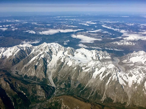
Annamite Range
Major mountain range dividing the Mekong basin from Vietnam's coast.

The Annamite Range is a major mountain range of Mainland Southeast Asia, extending approximately 1,100 km (680 mi) through Laos, Vietnam, and a small area in northeast Cambodia. It runs parallel to the Vietnamese coast in a gentle curve, dividing the basin of the Mekong River from Vietnam's narrow coastal plain along the South China Sea. Most of the crests are on the Laotian side. The eastern slope rises steeply from the plain, drained by numerous short rivers, while the western slope is more gentle, forming significant plateaus before descending to the banks of the Mekong. The range itself has three main plateaus: Phouane Plateau, Nakai Plateau, and Bolaven Plateau.
- highest_point
- Phou Bia at 2,819 m (9,249 ft)
Lore & Background
The Annamite Range runs parallel to the Vietnamese coast in a gentle curve, with most crests on the Laotian side. Its eastern slope rises steeply from the plain, drained by numerous short rivers, while the western slope is more gentle, forming significant plateaus before descending to the Mekong. The range includes three main plateaus: Phouane Plateau, Nakai Plateau, and Bolaven Plateau. Laos lies mostly within the Mekong basin, west of the divide, although most of Houaphan Province and a portion of Xiangkhoang Province (where the famous Plain of Jars is located) lie east of the divide. Most of Vietnam lies east of the divide, although Vietnam's Tây Nguyên (Central Highlands) region lies west of the divide, in the Mekong basin.
Reader's Guide
The Annamite Range is significant as a major geographic divide in Mainland Southeast Asia, separating the Mekong River basin from Vietnam's coastal plain. It forms an important tropical seasonal forest global ecoregion, the Annamite Range Moist Forests Ecoregion, which consists of two terrestrial ecoregions: the Southern Annamites montane rain forests and the Northern Annamites rain forests. The range is home to rare creatures such as the recently discovered Annamite rabbit and the antelope-like saola, the Douc langur, the large gaur, the Chinese pangolin, and formerly the Indochinese tiger. Historically, most of the highlands like the Annamite Range and the Central Highlands were populated by ethnic minorities who were not Vietnamese during the beginning of the 20th century. Demographics were drastically transformed with the arrival of 6 million settlers from 1976 to the 1990s, which led to ethnic Vietnamese Kinh outnumbering the native ethnic groups in the highlands.
Did You Know?
- The highest point of the Annamite Range is Phou Bia at 2,819 m (9,249 ft).
- The range extends approximately 1,100 km (680 mi) through Laos, Vietnam, and a small area in northeast Cambodia.
- The Annamite Range Moist Forests Ecoregion consists of two terrestrial ecoregions: the Southern Annamites montane rain forests and the Northern Annamites rain forests.
- The range is home to the recently discovered Annamite rabbit and the antelope-like saola.
- From 1976 to the 1990s, 6 million settlers arrived in the highlands, leading to ethnic Vietnamese Kinh outnumbering native ethnic groups.
Physical Geography & Topography
Stretching approximately 1,100 km (680 mi) through Laos, Vietnam, and a small area in northeast Cambodia, the Annamite Range stands as one of Mainland Southeast Asia's most defining physical features. The range traces a gentle curve parallel to the Vietnamese coast, effectively splitting the Mekong River basin from the narrow coastal plain along the South China Sea. Most of the crests sit on the Laotian side of the divide, with Phou Bia reaching 2,819 m (9,249 ft), followed by Phu Xai Lai Leng at 2,720 m (8,920 ft) and Ngọc Linh (Ngoc Pan) at 2,598 m (8,524 ft). The two flanks of the range present starkly different landscapes. The eastern face climbs steeply from the plain, drained by numerous short rivers, while the western face descends more gradually, giving rise to three main plateaus—Phouane Plateau, Nakai Plateau, and Bolaven Plateau, from north to south—before eventually reaching the banks of the Mekong. Important mountain passes such as the Nape Pass and the Mụ Giạ Pass have long served as critical corridors through this formidable barrier.
Ecology & Rare Biodiversity
The Annamite mountains support a globally significant tropical seasonal forest ecoregion, formally recognized as the Annamite Range Moist Forests Ecoregion. This designation encompasses two distinct terrestrial ecoregions: the Southern Annamites montane rain forests and the Northern Annamites rain forests. The range has become synonymous with extraordinary biodiversity, sheltering a roster of rare and remarkable creatures. Among its most celebrated residents are the recently discovered Annamite rabbit and the saola, a striking antelope-like animal. The forests also provide habitat for the Douc langur, the large gaur, the Chinese pangolin, and formerly the Indochinese tiger. The concentration of such unusual and vulnerable species within a single mountain system underscores why the Annamite highlands hold such a prominent place in global conservation discourse for Southeast Asia.
Etymology & Cultural Naming
The mountain range bears a remarkable collection of names that reflect the layered linguistic history of the region. In Lao, it is called Phū Lūang, while Vietnamese speakers refer to it as Dãy Trường Sơn. In English-language usage, the range appears under several variants: the Annamese Range, the Annamese Mountains, the Annamese Cordillera, the Annamite Mountains, and the Annamite Cordillera. The root of these English names traces back to the Chinese term Ān Nán (安南), which translates as 'the tranquil south' and was historically used to refer to Vietnam. Vietnamese speakers adopted and pronounced this term as 'Annam.' French speakers subsequently borrowed the word and applied 'Annamese' or 'Annamite' as designations for Vietnamese people themselves. Thus, the very name of the range carries within it a complex web of Chinese, Vietnamese, French, and Lao linguistic heritage, making it a small but telling artifact of the region's intertwined cultural history.
Demographic Transformation of the Highlands
At the beginning of the 20th century, the highland regions encompassing the Annamite Range and the Central Highlands were predominantly populated by ethnic minority communities who were not ethnically Vietnamese. These groups constituted the primary inhabitants of the mountainous terrain during that era. However, a profound demographic shift fundamentally reshaped the social composition of these highlands in the latter decades of the 20th century. From 1976 to the 1990s, approximately 6 million settlers arrived in the region, dramatically altering the ethnic balance that had existed for decades. The result was a striking reversal: the ethnic Vietnamese Kinh, who had previously been a minority presence in these highland areas, came to outnumber the native ethnic groups. This wave of settlement represents a drastic transformation of the demographics in the Annamite highlands, permanently changing the ethnic makeup of a region that had long been defined by its indigenous minority populations.
Frequently Asked Questions
What is the Annamite Range and where is it located?
The Annamite Range is a major mountain chain in Mainland Southeast Asia that stretches roughly 1,100 km through Laos and Vietnam. It runs parallel to the Vietnamese coastline, forming a natural spine along the region's eastern edge.
What is the highest point in the Annamite Range?
The range's summit is Phou Bia, which rises to 2,818 metres (9,245 ft) above sea level. It sits within the Lao portion of the range and is one of the tallest peaks in all of Laos.
Why is the Annamite Range geographically significant?
It acts as a natural divide, separating the vast Mekong River drainage basin to the west from Vietnam's narrow coastal plain that borders the South China Sea to the east. This split shapes the hydrology, climate, and settlement patterns of both countries.
How long is the Annamite Range?
The chain extends for approximately 1,100 kilometres from north to south, making it one of the longest continuous mountain systems in Southeast Asia.
Which countries does the Annamite Range pass through?
The range runs through both Laos and Vietnam, with much of its length forming or lying near the border between the two nations. It is most closely associated with the Vietnamese side, where it parallels the coast.
More in Mountain Ranges And Massifs 1-24
Elsewhere in the Mountain Ranges And Massifs universe
Spotted an error? Know more?
This is a living reference — every entry is fact-audited, and reader corrections feed straight into our audit queue. Suggest an edit · See this site's audit record