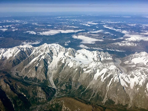
Apuseni Mountains
Mountain range in Transylvania with about 400 caves.

The Apuseni Mountains (Romanian: Munții Apuseni, "Western Mountains"; Hungarian: Erdélyi-középhegység, "Transylvanian Mountains") are a mountain range in Transylvania, Romania, belonging to the Western Romanian Carpathians. They are notable for their numerous caves (about 400) and their highest peak, Bihor Peak, at 1,849 metres (6,066 ft). The range does not form an uninterrupted chain but features many low and easy passes toward the Crișana and Pannonian Plain.
- Highest peak
- Bihor Peak at 1,849 metres (6,066 ft)
- Number of caves
- about 400
- Location
- Transylvania, Romania
- Mountain range
- Western Romanian Carpathians
- Climate
- temperate-continental with transitional nuances and oceanic influences
- Average annual temperature
- between 6 and 10°C
- Annual precipitation
- 700-1000 mm/year
Lore & Background
The Apuseni Mountains have a complex paleogeographic evolution linked to the Western Carpathians. Crystalline schists began separating as early as the Precambrian period, becoming more defined in the Silurian due to the Caledonian orogeny and especially in the Carboniferous from Hercynian movements. Uplift occurred in the Cretaceous period as a result of Alpine orogenesis, accompanied by subsidence that formed depressions such as Gurahonț and Brad. Volcanic activity in the second half of the Neogene period formed the Metaliferi Mountains. The range reached its final elevation at the beginning of the Quaternary period, when waters receded from depressions and the hydrographic network formed.
Reader's Guide
The Apuseni Mountains are significant as a distinct section of the Western Romanian Carpathians, characterized by their fragmented structure and numerous caves. Their paleogeographic history reflects major orogenic events from the Precambrian through the Quaternary, including Caledonian, Hercynian, and Alpine movements, as well as Neogene volcanism. The mountains support a temperate-continental climate with oceanic influences, with average temperatures of 6–10°C and precipitation of 700–1000 mm/year. Vegetation includes deciduous and coniferous forests above 1300 m, and fauna includes red foxes, grey wolves, martens, red deer, roe deer, squirrels, and brown bears. The Apuseni Natural Park hosts 45 species of mammals and birds such as western capercaillie, lesser-spotted eagles, golden eagles, and woodpeckers. The range is bounded by the Barcău River to the north, the Mureș River to the south, the Transylvanian Plateau to the east, and the Crișana plains to the west. Its subdivisions include the Criș Mountains, Seș-Meseș Mountains, Bihor Massif, and Mureș Mountains.
Did You Know?
- The Apuseni Mountains have about 400 caves.
- The highest peak is Bihor Peak at 1,849 metres (6,066 ft).
- Volcanic activity in the second half of the Neogene period formed the Metaliferi Mountains.
- The Apuseni Natural Park is home to 45 species of mammals.
- The range is bounded by the Barcău River to the north and the Mureș River to the south.
Frequently Asked Questions
Who is Apuseni Mountains?
The Apuseni Mountains are a mountain range located in Transylvania, Romania, and they belong to the larger Western Romanian Carpathians system. In Romanian they are called Munții Apuseni ("Western Mountains"), while Hungarian speakers refer to them as the Transylvanian Mountains.
What are Apuseni Mountains's powers/role?
The range is most celebrated for its extraordinary karst landscape, which shelters roughly 400 caves of varying sizes. Its tallest point is Bihor Peak, standing at 1,849 metres (6,066 ft), and the terrain is dotted with low, easily crossed passes rather than a single imposing wall.
How does Apuseni Mountains's story end?
Instead of terminating in a dramatic cliff face, the range dissolves into a series of gentle, low-lying passes that spill westward toward the Crișana region and the Pannonian Plain. This fragmented, open topography has long served as a natural route for travellers moving between Transylvania and the plains beyond.
Why is Apuseni Mountains important?
The range anchors the western edge of the Transylvanian Basin and provides a temperate-continental climate with mild oceanic influences, keeping average annual temperatures in the 6-to-10 °C band. Its blend of hundreds of caves, moderate summits, and accessible passes makes it a central geographic and outdoor-recreation landmark in western Romania.
What is Apuseni Mountains's home base?
The range sits entirely within Transylvania, Romania, as a constituent part of the Western Romanian Carpathians. It occupies the western flank of the Transylvanian Basin, with its lower reaches opening onto the Crișana lowlands and the broader Pannonian Plain to the west.
More in Mountain Ranges And Massifs 1-24
Elsewhere in the Mountain Ranges And Massifs universe
Spotted an error? Know more?
This is a living reference — every entry is fact-audited, and reader corrections feed straight into our audit queue. Suggest an edit · See this site's audit record