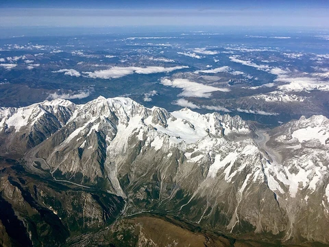
Arakan Mountains
Mountain range dividing Rakhine coast from central Myanmar.

- location
- western Myanmar, between Rakhine State coast and Central Myanmar Basin
- native_name
- Rakhine Yoma (Burmese: ရခိုင်ရိုးမ)
- formation
- compression from Indian Plate colliding with Eurasian Plate
- ecoregion
- Chin Hills-Arakan Yoma montane forests
Lore & Background
The Arakan Mountains were formed by compression as the Indian Plate collided with the Eurasian Plate, producing the Naga-Patkai foldbelt. The range acts as a barrier to the southwestern monsoon rains, making the western slopes extraordinarily wet during the monsoon with typically over 1 metre (39 in) of rain per month, while the eastern slopes are much drier.
Reader's Guide
The Arakan Mountains have historically divided the Rakhine coast from the rest of Myanmar, acting as a barrier between the peoples of central Myanmar and those of the Indian subcontinent. This fostered the separate development of the Rakhine people linguistically and culturally from the Burmese, and allowed Arakan to develop as a separate political entity. Coastal cities such as Mrauk U and Waithali formed the core of Arakan civilization. The mountains are crossed by a road between Ann and Minbu and by an all-weather road from Taungup to Pyay on the Irrawaddy.
Did You Know?
- The word Arakan is derived from the Sanskrit word Rakshasa meaning demon, a term used to refer to the inhabitants of the region.
- The mountain chain is submerged in the Bay of Bengal for a long stretch and emerges again as the Andaman and Nicobar Islands.
Frequently Asked Questions
Who is Arakan Mountains?
The Arakan Mountains, natively called Rakhine Yoma, are a major mountain chain in western Myanmar that stretches from Cape Negrais in the south up to Manipur, India, in the north. They form the structural backbone of the region, separating the Rakhine coastal strip from the Central Myanmar Basin.
Why is Arakan Mountains important?
The chain acts as the defining geographic divide between Myanmar's western coast and its central lowlands, shaping regional climate, river drainage, and human settlement patterns. It also encompasses the Naga Hills, Chin Hills, and Patkai range, making it a key structural component of the broader Indo-Burman system.
More in Mountain Ranges And Massifs 1-24
Related in Mountain Ranges And Massifs
Links follow this subject's own source article.
Elsewhere in the Mountain Ranges And Massifs universe
Spotted an error? Know more?
This is a living reference — every entry is fact-audited, and reader corrections feed straight into our audit queue. Suggest an edit · See this site's audit record